The difference is obvious to those willing to eat the pickleweed.

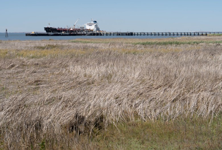
In the south part of Pacheco Marsh, it’s dry and salty — the latter from when it was still subject to the tide of Suisun Bay, said Paul Detjens, a senior civil engineer from the Contra Costa County Flood Control and Water Conservation District. “This pickleweed is looking pretty crunchy,” Detjens said. “The last time this area had significant water was summer of 2017, when we came out of the last drought.
Later in the tour and much closer to the shoreline of Suisun Bay, the project manager again chewed pickleweed, this time plucked from a greener patch buffeting the tide from the earthmovers. “This is a much healthier wetlands ecosystem,” Detjens said. “This is what pickleweed is supposed to look like.”

Contra Costa County isn’t spending more than $11 million on a massive wetlands project to make its weeds taste better. The Lower Walnut Creek Restoration Project, the largest public works project in county history, has been years in the making.
But once the Board of Supervisors approved the $11.285 million contract with Four M Contracting Inc. in March, shovels were in the dirt only a few weeks later.
With partner John Muir Land Trust, the county’s goal is restoring 200 acres of wetlands habitat in the 300-acre project between the Benicia-Martinez Bridge and the Marathon Petroleum refinery to the southeast.
An industrial buffer to the Bay

The Walnut Creek watershed is Contra Costa’s largest, draining more than 150 square miles from eight cities into a marsh that, over the past century, became a dumping ground for dredging and an industrial buffer to the bay.
Engineers want to enhance the area’s flood-carrying capacity, while naturalists want conditions closer to those existing before humans channelized the marsh and brought industry.

When the project is done in 2023, it will likely become a magnet for bird lovers.
“As a bird watcher, I’m ecstatic about the project,” said Alan Bade, a Pleasanton Hill resident and member of the Mt. Diablo Audubon Society. “Many, many shore birds, non-migratory and migratory birds will be attracted to the new habitat.”
“The kind of birds that we’ll have here, they tell me people will travel a thousand miles to come out here with their scope to see an endangered black rail or a ridgeways rail,” Detjens said. “People will travel and make this a destination.”
For that purpose, much of the dirt being moved now will go into three elevated vistas, more than 20 feet high, surrounded by hiking trails, boardwalks, and bridges over the marsh’s northern reach.
More than 80 species of birds have been recorded at Pacheco Marsh, said Krista Vossekuil, the director of philanthropy at the John Muir Land Trust and board member of the Mt. Diablo Audubon Society. Expect more to arrive when the project is finished.

Channeling a healthier marsh
“The site provides important foraging grounds as well as refuge for migratory species including the short-eared owl, and we anticipate bird life to increase as the quality of habitat is improved over time,” Vossekuil said. “It is also home to charismatic raptors such as white-tailed kites, American kestrels, and northern harriers. I have also spotted a common bird in steep decline — the loggerhead shrike.”

Detjens and a biologist stood near an excavator digging a 5-foot-deep, 10-foot-wide channel leading through the marsh. Trenches spread out like veins bringing necessary blood through a human body. Only in this case, it’ll be channel offshoots bringing necessary water to the dried-up marshland.
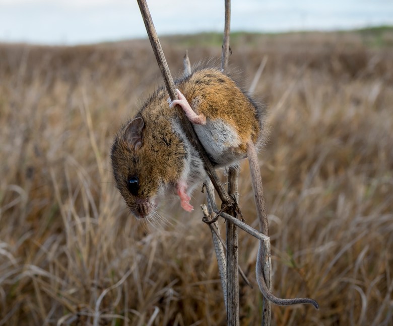
The biologist is there, as is 7 miles of temporary orange fencing, because it’s where the endangered salt marsh harvest mouse lives. Once the marsh gets re-flooded, the mice will be fair game for the predatory birds it attracts.

“This used to be fully tidal, and what that means is it’s been diked off and drained and then dredge material was pumped through here,” Detjens said. “It filled up, and what that means is that habitat has really changed and it’s not really a very functional marsh. This really has the potential to be lush and vibrant.
“We’re cutting a big channel that will take the tides from out in Suisun Bay twice a day, and bring it all the way up here, in and out, like a breath.”
The site is just over the hill from the Al McNabney Marsh, across Interstate Highway 680 from the Martinez Refining Company.
“People want to have that experience with the water,” Detjens said. “There really isn’t a spot to do that from the Martinez Marina over to Bay Point Regional Shoreline — there’s nothing here, unless you’re trespassing.”

Until the mid-19th century, there were grizzly bears and elk in the marsh and salmon and steelhead spawned in Walnut Creek. Then humans arrived, filling in wetlands and building dikes.
Merchant ships sailed up Walnut Creek and other creeks feeding into Walnut Creek were diverted for humans developing Contra Costa. Refineries were built and the area was used as a dumping ground for dredging projects all over the Bay Area.
The county bought 122 acres of the marsh in 2003 from a towing company that once planned a junkyard there. Marathon bought another 18 adjacent acres used for sand mining, and donated it to the land trust in 2020.
A project fueled by hope
The project can’t undo everything humans have done. Game fish will likely not return to Walnut Creek to spawn, Detjens said. Which isn’t stopping people from hoping.
“I personally have seen large chinook salmon in lower Walnut Creek that can’t get past drop structure number one,” said Bade, also a co-founder of Friends of Pleasant Hill Creeks. “While the new marsh won’t solve this issue, it will provide much better habitat for anadromous fish in the lower reach. It’s a great first step.”
More fish will bring more predators. And more humans.

Planners envision the Iron Horse Regional Trail, which now ends near state Highway 4, to extend another 3 miles along Walnut Creek into Waterbird Regional Preserve near Martinez. There will be another 2.4 miles of trails into the marsh, with a staging area, parking lot, bird-watching blinds and interpretive panels in the elevated areas.
“This is super engineered by super scientists,” Detjens said. “It’s purposely designed to look simple and natural, but as you look at the sizes of the channels, those are all sized based on the tidal prism which you need to have water flowing in and out.”
It’s also being engineered with the future in mind. Viewing spots, the access road and parking lots will be high enough to survive rising seas.
“We have a better chance here than in many other locations around the bay, to design something that will keep up with sea level rise,” Detjens said. “As habitat gets more inundated over time and becomes more filled in with sediment, that habitat — the bottom is going to rise up in conjunction with the sea level rising. And what happens is a graduated slope, that habitat is going to move up very slowly, over years and decades. So the pickleweed might be here in 2022 and in 2023 it might be six inches higher.”
“We’re also over-building the elevations of the trails and things to an elevation higher than we think they need to be in. Even the road coming down, (we’re) raising the existing road up 4 feet. As more tides come in, we want that road to be serviceable mid-century and into the 2100s.”

As the marsh transforms, rising water will blend with more sediment, acting as a carbon filter helping restrain greenhouse gases. The flood district will add 31,000 new native plants to the area. There’s also talk of other amenities, like a kayak launch, which is still up in the air. Though the entire project is called Lower Walnut Creek Restoration, the northern reach — the section north of Waterfront Road — will be managed by the land trust and called Pacheco Marsh. The southern reach will include levee improvements.
“Mother Nature is going to make it an equilibrium, but it’s our job as engineers to get as close as possible to what Mother Nature wants to do,” Detjens said. “So she doesn’t just remodel right after we build it. She can tweak it a little bit and fine tune it, but we want to do the best we can to get it as close as possible to what it was.”

